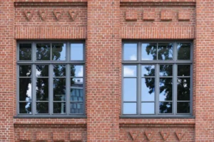
Authentic and Stylish Sash Windows
Sash Windows in Surrey
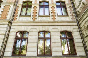
Are you looking for the designers and installers of sash windows Surrey property owners recommend? Then you have come to the right place. We are Kingswood Joinery UK Ltd, and we were formed in 2006 to bring homeowners and businesses in and around Surrey individual and unique window products. Our windows and doors are handcrafted at our fully equipped workshop in Southend, Essex, by joiners with exceptional experience and training. Members of our skilled team are City & Guilds qualified and FENSA registered too, so you can be sure that your project is in the most capable hands.
Our company is renowned for combining the latest technology with traditional design to make elegant windows that stand the test of time. All our sash and casement windows perform well in terms of energy efficiency, and our doors meet high-security standards. So, if you are looking for sash windows in Surrey that will stand the test of time, ours will certainly rise to the challenge!